Hydro Modelling & Consultancy

Our multi-talented crew offer a range of expertise within the natural and built environment including some ground-breaking technological approaches to hydro modelling. But what exactly do we mean when we talk about “a model”?

A model is the stunt double for a real system.

We use them when it’s easier to work with the substitute than the real thing. Engineering blueprints, geological maps and weather forecasts are examples of models, and they allow us to experiment with ideas and designs for the real system. Water balance models in particular, simulate water flow to help us understand the water cycle in detail, and predict how it may react to changes induced by things like climate change and population growth.

Core capabilities

  • Proprietary Coupled groundwater & surface water catchment scale modelling
  • 1D and 2D flood risk modelling experience using Flood Modeller, TUFLOW, ESTRY, HEC-RAS, INFOWORKS and MIKE11
  • Hydrological assessments including UK specific methods outlined in the Flood Estimation Handbook
  • Rainfall runoff modelling using models such as GR6J, GR4J, SIMFLOW, ReFH and HEC-HMS
  • Groundwater modelling using Analytical Element Methods and software such as MODFLOW
  • Use of GIS software including scripting of tools

Our experience

We are not your average consultants. We are unique in that although we are specialists in applied maths and physics, we also have years of field experience logging soil samples and rock core, running the night shift on a pumping test, standing in a cold stream to take measurements, and field-repairing our instruments.

We have hydrogeological project experience across the globe, from the karst regions of Ireland to the rainy climates of England and Wales, the arid regions of Australia and the Middle East and to the rain forests, Great Plains and northern boreal forest of North America.

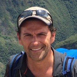
Mr. Jason Morrissey
M.Eng., C.Eng., C.WEM.

Senior Groundwater Hydrologist with 20 years of engineering consultancy experience. He specializes in applied mathematics and physics of aquifer systems and well hydraulics. Jason has worked on mining, infrastructure, environmental and geotechnical projects within Canada, Europe and the Middle East. Jason is a Member of the United Kingdom Engineering Council

Mary Jeddere-Fisher
MA MSc. CMath

Mary Jeddere-Fisher is a genuinely world class hydro specialist and mathematical problem solver.  She holds a 1st Class degree in applied mathematics from Cambridge University and Masters degree in fluid dynamics. Adding to her formidable academic record, she has a flare for coding and over a decade of applied knowledge and experience in large scale strategic hydrological and hydraulic assessments using a range of tools and software platforms. 

Innovation

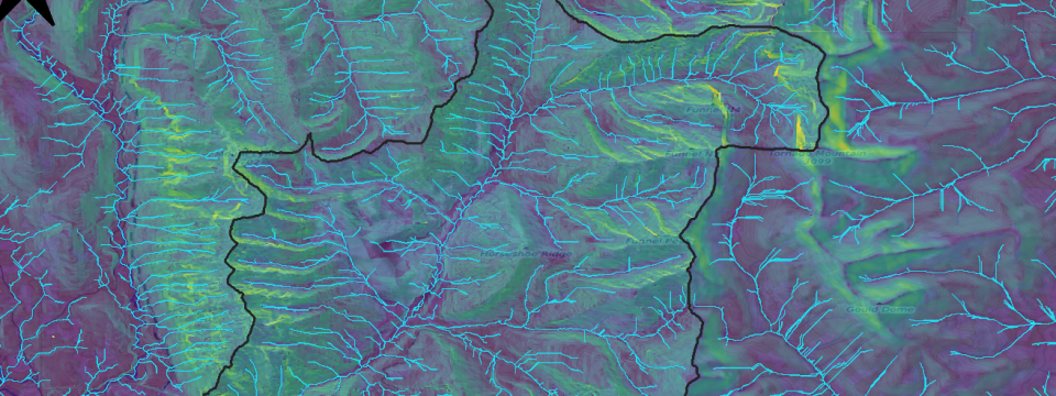
Coupled groundwater & surface water catchment scale modelling

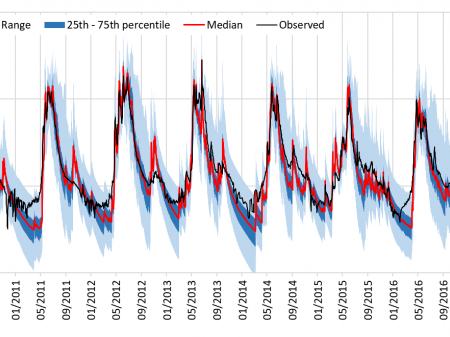
Our ground-breaking approach to modelling surface and groundwater flows at catchment scale outperforms the nearest competitor on speed, agility, and efficiency. Our innovation is:

  • Unique to Yellow Sub Geo
  • Dramatically faster with comparable levels of accuracy and reliability
  • Has excellent calibration and agreement with observed reality

Historically surface and groundwater systems have been treated separately – although they are part of the same system. However, there is an increasing desire to understand both the surface and groundwater system as a singular system to facilitate the design and potential impacts of cities, industrial complexes, forestry practices, agriculture, and mines.

With this challenge, our innovation came to be. The heart of mathematical modelling is not calculations but rather problem solving.

“Inside every large problem is a small problem struggling to get out” – Tony Hoare

MORE ON MODELLING

Geo-environmental modelling:  What are they good for?

In the geo-environmental world modelling soil and groundwater for geotechnical and contaminant transport purposes is very common.  However, despite their widespread use, there appears to be some confusion over the purpose of a model.

It is generally recognised that models are typically created for three purposes: 
1) to test the effects of changes in a system,
2) to develop scientific understanding of a system, and
3) to aid in decision making. 

It seems that many believe that the purpose of modelling is to predict an outcome, where the outcome is an objective truth. However, a model cannot provide an objective truth. 

At best, a model (this includes all models geo-environmental) is a reasonable approximation of a real ‘system’.   As a rule, models are based on simplified physical processes, calculated by simplified maths, and all based on simplified conceptual understanding of how the system works.  In short, all models are inherently inexact.

So, if models are mere approximations, why do we bother to use them? Because approximations help us understand how the system will behave and with careful study of the model response and sound professional judgement models can be used to test optimistic and pessimistic conditions and assumptions.  Indeed, most geo-environmental models are developed to test pessimistic conditions and assumption so that reasonably conservative conclusions can be drawn.  In short, the purpose of a geo-environmental model is to enable sound decision making.  Nothing more.  Nothing Less.

So, let’s keep modelling (geo-environmental modelling in particular) in its proper perspective and leave the search for truth to the philosophers.

Contact

Let's connect

We're always keen to help

drop us a line and we'll be in touch soon.

UK: (+44) 02920 099 310

helpme@yellowsubgeo.com